A Map of the Grand Duchy of Finland
Drawn in 1875 by I.J. Inberg
Awarded with the first prize in Helsinki 1876.

Legend:
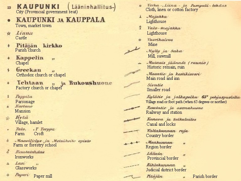
This map of land surveyor Isak Johan Inberg (1835-1893) has been characterized as the best general map of Finland published in the Grand Duchy.
Electronic presentation: Pauli Kruhse (© 2006)
The scale of the original map is 1:1,000,000. Sheets covering the northern part of Finland will be published here later.
Back to the list of history pages.